Skip to main content
hide
Hide
UK and Ireland: Maps
- The Great Britain Historical Geography Information Service (GBHGIS) provides a mass of information about Britain's localities as they have changed over time. Information comes from census reports, historical gazetteers, travellers' tales and historic maps.
- A Vision of Britain Through Time, in the GBHGIS, provides maps and statistical information derived from census reports covering the period 1801-2001, searchable by place name or post code.
- The Landmark Information Group sell online 19th Century Ordnance Survey maps linked from an extensive gazetteer. These are at a scale of 1:10,560 (6 inches to the mile) and cover all of Great Britain (England, Scotland and Wales).
- Maps showing the counties in England, Scotland and Wales and in Ireland prior to the 1974 re-organisation (1975 for Scotland). These maps show the familiar three-letter Chapman Codes.
- The National Library of Scotland provides scanned map images of various series of Ordnance Survey maps of Scotland, England and Wales from the mid-19th century to 1970s.
- Catalogue of British Town Maps - "locates town maps extant in UK public archives and libraries. It provides details of almost 8,000 maps and provides for each the key cartographical and other features and the location of publicly-accessible exemplars. Associated with each catalogue entry is a PDF image outlining the area covered by the map."
- Kain, R.J.P. and Oliver, R. British Town Maps: A History. British Library Publishing Division (2015) 240 pp. [ISBN-10: 0712357297]
- Genmaps - a very large collection of scanned maps of England, Wales and Scotland.
- Old Maps Online: "the easy to use gateway to historical maps online in libraries around the world".
- County maps (archived copy) showing the parish boundaries, the probate jurisdiction, and the date of commencement of registers, are available from The Institute of Heraldic and Genealogical Studies.
- The Bodleian Library Map Room.
- Streetmap.co.uk provides up-to-date street maps for all of mainland Britain. A similar service is provided by Multi Media Mapping and Bing.
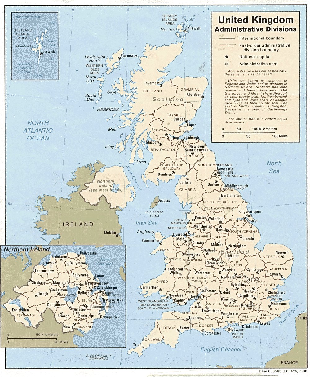
- A modern map of the United Kingdom.
- The Association of British Counties website includes a very useful map showing the 86 historic counties of Great Britain.
- Alan Gresley provides a set of high quality scans of maps from Baedeker's Great Britain (archived copy), Handbook for Travelers by Karl Baedeker (7th ed., 1910).
- Geography and National Statistics - explanatory pages from The Office of National Statistics
- Cassini publish historical Ordnance Survey maps of England and Wales that have been scanned, digitally re-projected and enlarged to match the present-day Landranger © series - and provide Mapmaker, a web-based search facility that allows a user to centre a map on a postcode or placename, ready for downloading or printing.
- Francis Frith sells Victorian county maps, by the Ordnance Survey and Samuel Lewis.
- British Isles Maps and Views - "free access to high quality scans of rare and beautiful antique maps and views", from MAPCO.
- Detailed scans of 1950s Ordnance Survey Maps - the New Popular Edition (in England and Wales), and the earlier sheets from the 7th Edition (in Scotland / Northern England).
- Detailed scan of the Map of England & Wales by S. Lewis & Co., London c1840, provided by MAPCO.
- Digimap - a subscription service available to UK Higher Educational Institutions that provides online access to "all available County Series maps at 1:2,500 and 1:10560 scales published between 1843 and 1939; and all available National Grid maps at 1:1,250, 1:2,500 and 1:10560/10,000 scales published from 1945".
- FamilySearch's Maps facility can be used to find parishes and see their parish boundaries overlaid on a modern Ordnance Survey map.
- Advice for family historians, concerning the use of maps and gazeteers, from the History of Cartography pages in WWW-Virtual Library:History.
- Maps for Family and Local History - from the National Archives.
- The Royal Collection Trust 's George III Collection of Military Maps contains numerous maps of England, and some of Wales and of Scotland.
- The British Historic Towns Trust Atlas provides free-to-download Atlases and maps of Britain's historic towns and cities.
